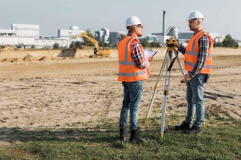
Geoland

Year experience
0 +
Satisfied client
0 +
award winning
0

welcome to geoland

Explore the Land with Precision & Expertise

Lorem ipsum dolor sit amet, consectetur adipiscing elit. Ut elit tellus, luctus nec ullamcorper mattis, pulvinar dapibus leo.

Comprehensive Survey Solutions for Your Needs

Our Services

Lorem ipsum dolor sit amet, consectetur adipiscing elit. Ut elit tellus, luctus nec ullamcorper mattis, pulvinar dapibus leo.

Boundary Surveys

Lorem ipsum dolor sit amet, consectetur adipiscing elit. Ut elit 

Topographic Mapping

Lorem ipsum dolor sit amet, consectetur adipiscing elit. Ut elit 

Construction Staking

Lorem ipsum dolor sit amet, consectetur adipiscing elit. Ut elit 

Trusted Expertise

Lorem ipsum dolor sit amet, consectetur adipiscing elit. Ut elit tellus, luctus nec ullamcorper mattis, pulvinar dapibus leo.

Precision Guaranteed

Lorem ipsum dolor sit amet, consectetur adipiscing elit. Ut elit tellus, luctus nec ullamcorper mattis, pulvinar dapibus leo.

Client-Focused Approach

Lorem ipsum dolor sit amet, consectetur adipiscing elit. Ut elit tellus, luctus nec ullamcorper mattis, pulvinar dapibus leo.

Why choose us

Your Trusted Survey Partner

Lorem ipsum dolor sit amet, consectetur adipiscing elit. Ut elit tellus, luctus nec ullamcorper mattis, pulvinar dapibus leo.

Project

Precision in Every Project

Lorem ipsum dolor sit amet, consectetur adipiscing elit. Ut elit tellus, luctus nec ullamcorper mattis, pulvinar dapibus leo.

City Planning

Urban Development Survey

Lorem ipsum dolor sit amet, consectetur adipiscing elit. Ut elit tellus, luctus nec ullamcorper mattis, pulvinar dapibus leo.

Infrastructure Development

Highway Expansion Mapping

Lorem ipsum dolor sit amet, consectetur adipiscing elit. Ut elit tellus, luctus nec ullamcorper mattis, pulvinar dapibus leo.

Real Estate Survey

Commercial Property Analysis

Lorem ipsum dolor sit amet, consectetur adipiscing elit. Ut elit tellus, luctus nec ullamcorper mattis, pulvinar dapibus leo.

Coastal Erosion Study

Coastal Erosion Study

Lorem ipsum dolor sit amet, consectetur adipiscing elit. Ut elit tellus, luctus nec ullamcorper mattis, pulvinar dapibus leo.

Testimonial

Voices of Satisfaction From Our Client

The land survey team provided exceptional service. Their attention to detail and accuracy were impressive. Highly recommend for any surveying needs!
John Doe
Client
We were thrilled with the survey results. The team was professional, timely, and precise. Will definitely use their services again.
Drew Feig
Client
Efficient and reliable surveyors. They delivered accurate results and great customer support throughout the project. Fantastic experience overall
Hannah Morales
Client

Contact Us

Get in Touch With us

FAQs

Frequently Ask Question

Lorem ipsum dolor sit amet, consectetur adipiscing elit. Ut elit tellus, luctus nec ullamcorper mattis, pulvinar dapibus leo.

A land survey determines the precise boundaries, dimensions, and features of a property. It’s essential for identifying legal property lines, which helps in avoiding disputes and ensuring accurate property descriptions.

The duration of a land survey depends on the size and complexity of the property. Typically, a standard residential survey takes a few hours to a day, while larger or more complex surveys may take several days.

A land survey ensures you understand exactly what you’re purchasing. It confirms the property’s boundaries, identifies any encroachments or easements, and helps protect your investment by avoiding legal issues related to property lines.

The cost of a land survey varies based on the size, location, and complexity of the property. Residential surveys generally range from a few hundred to several thousand dollars. Contact us for a detailed quote based on your specific needs.

A land survey report typically includes a detailed map of the property, showing boundaries, buildings, improvements, and any natural features like trees or water bodies. It may also include descriptions of any easements, rights-of-way, and zoning restrictions.

You should consider getting a land survey when buying or selling property, before starting construction, when subdividing land, or when there’s a dispute over property boundaries. It’s also advisable to update your survey if significant changes have been made to the property.

We offer a variety of land surveys, including boundary surveys, topographic surveys, ALTA/NSPS land title surveys, construction staking, and more. Each type of survey serves a specific purpose depending on your needs.

Yes, a land survey can identify any easements that exist on your property. Easements are legal rights that allow others to use a portion of your land for specific purposes, such as utilities or access roads.

Land surveys are highly accurate, with professional surveyors using advanced equipment and methods to measure property boundaries. However, minor discrepancies can occur, especially in older surveys. Always use a licensed surveyor to ensure the highest accuracy.

Yes, it’s highly recommended to have a surveyor’s report before starting any construction. The report ensures that you build within the legal boundaries of your property and comply with local zoning and setback regulations.

Blog Post

Read Our Latest News and Articles

Lorem ipsum dolor sit amet, consectetur adipiscing elit. Ut elit tellus, luctus nec ullamcorper mattis, pulvinar dapibus leo.